|
|
♣♣ Pictures Menarik sekitar Kedah & Perlis ♣♣
[Copy link]
|
|
|
sahira ,
nak tanya... umah tu kalau nak pi kangaq belah kanan ka.. paklang macam pernah pi ja umah tu dolu dolu.. |
|
|
|
|
|
|
|
|
|
|
|

Awek Kedah kira pemandangan menarik jugak ka?
(skodeng time kenuri .. Pengantin dok sebok hal lain, aku tembak subjek lain dulu ) .. Pengantin dok sebok hal lain, aku tembak subjek lain dulu ) |
|
|
|
|
|
|
|
|
|
|
|
 | Waterfalls for thewhole family |
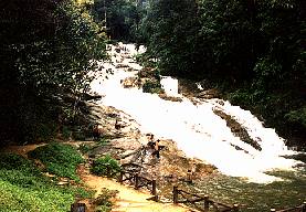
The Very popular Lata Bayu This is a very old recreation area and also a renowned spot in the northernmost part of the country. The famous Baling area, a town where meetings with the then Communist insurgents were held! Some 3 kilometers out of town and a branch road to north Kedah, places like Sik, Weng etc. On the way [15 kilometers later] in the village of Assam Java, good and prominent signage directs you to 3 kilometers Park road! The Waterfall is a finale to series of rapids ending up with a cascades. Total height of the continuous slide is about 30 meters high. A beautiful pathway follows the left bank all the way until a level plain on top of the rapids.
There is only one small vertical fall of 2 meters at the end of this stretch.
|  |
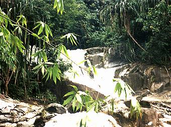 | Top A closer look at the place after transition from rapids to cascades. This is good 6 meters drop to start the waterfall
|
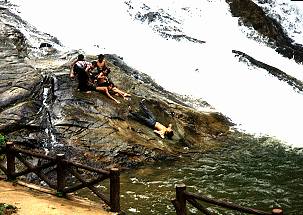 | Bottom At the base of the waterfall, a fair size pool collects the water.
Children capitalizing on the smooth rock surfaces to enjoy the slide and dropping into a pool.
|
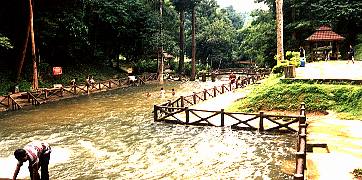
The local authority had landscape the park in a very impressive manner. This is one of the very well managed Park of Kedah. Pool with fair depth and clear flowing water.
|  |
Having visited the Park, it is difficult to understand how the Park acquired its reputation as a fantastic weekend destination. |
|
|
|
|
|
|
|
|
|
|
|
| Bukit Hijau Recreation Park |
| State | Kedah | | Location | Off the 67 road between Sg Petani and Baling | | Coordinates and map | N05 29.86' E100 46.39' | | Water Source | Stream | | Waterfall Profile | Cascades, Vertical Falls | | Accessibility | Recreational Park |
Well maintained recreation park in Kedah
The beautiful series of waterfalls of Bukit Hijau can be reached easily from road 67. About 25 km from Baling, turn south at a clearly signposted junction. From here it is 12 km to the carpark of Bukit Hijau 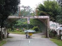 The big entrance gate makes clear that this park can be busy on weekends. | 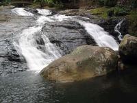 A cemented path leads to the first fall, more a cascade | 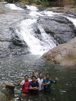 The large pool invites for a refreshing bath |
Several waterfalls and cascades
A good walkway leads to the higher falls. In several places sturdy bridges have been built across the stream 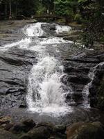 At the top of the first cascades a first bridge is built | 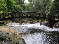 A view back under the bridge at the first cascades | 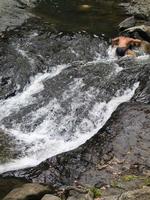 Youngsters try to catch fish under the rocks | [/tr]
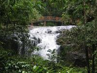 The second waterfall just before you reach the second bridge | 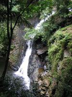 This waterfall has a nice pool, but the slopes are too steep. Fences have been erected to avoid accidents | 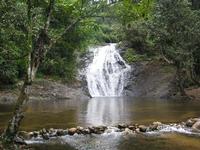 The upper falls also have very large and nice pools | [/tr]
After the end of the cemented walkway, a clear trail continues to the upper falls 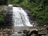 The last fall is a beauty, with a very attractive pool | 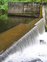 Beyond the last fall there is this dam. | 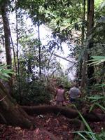 The upper part of the trail requires some scrambling |
|
|
|
|
|
|
|
|
|
|
|
|
| State | Kedah | | Location | Pulau Langkawi | | Coordinates and map | N06 24.11' E99 49.22' | | Water Source | Stream | | Waterfall Profile | Near Vertical Falls | | Accessibility | From carpark |
This waterfall is located on the northern slope of Gunung Raya, the highest mountain of Langkawi. Still, the water flow is seasonal and the fall can best be visited during the rainy season, September-October. Access is easy and clearly signposted. 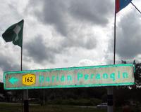 Signboard to the waterfall | 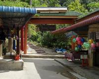 Entrance of the Recreational Park | 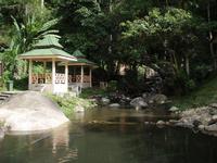 Well-maintained park |
The waterfall has several tiers. A path leads up to the falls and there are shelters 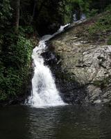 The lower fall | 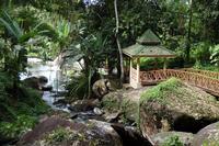 There are several shelters along the path | 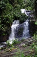 The middle fall | [/tr]
From the top of the upper fall, you have a nice view of the fields below and the coast. 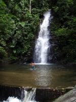 The upper fall | 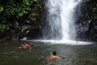 With a nice pool | 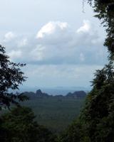 View from the top of the upper fall |
|
|
|
|
|
|
|
|
|
|
|
|
|
| State | Kedah | | Location | Guning Jerai | | Coordinates and map | N05 46.52' E100 24.13' | | Water Source | Stream | | Waterfall Profile | Several small falls, cascades | | Accessibility | Recreation Park |
There are several places around Gunung Jerai with the name Batu Hampar. This Recreation Park can be reached easily from Yan. Just outside Yan there is a junction where you take right to Batu Hampar. The falls are not spectacular but the stream is nice and quiet. 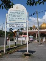 The signboard just outside Yan | 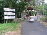 The entrance of the Recreation Park | 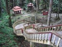 Stairs lead down to the stream where there are shelters and picknick places |
A trail leads to a few small, but pleasant waterfalls. We visited the place during the dry season, during the monsoon the water flow will be bigger. 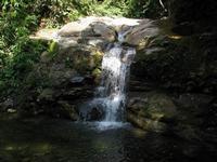 One of the small falls | 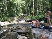 A nice place to spend a lazy day | 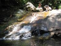 A natural slide | [/tr]
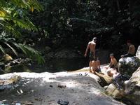 Life is not bad on a day like this | 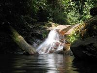 A small fall, but a nice big pool. | 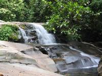 A quiet, peaceful atmosphere. | [/tr]
Add a comment
| | 
[/td] |
|
|
|
|
|
|
|
|
|
|
|
|
| State | Kedah | | Location | Between Sik and Baling | | Coordinates and map | N05 51.99' E100 50.21' | | Water Source | Small river | | Waterfall Profile | Cascade & Vertical Fall | | Accessibility | From carpark |
Lata Mengkuang is located about 12 km from Sik off the road from Sik to Baling. From the road you can see the recreation area, which only attracts visitors during weekends. To reach the waterfall, take the tar road to the left just before you reach the Recreation area. After less than 1 km there is a gate where you can park your car. From there walk along the road for a few hundred meters to the fall. 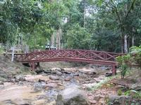 The recreation area along Sg Chepir is well maintained, but a bit desolate | 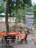 During weekends it will be more busy. | 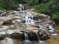 At the end of the road it is not far to the main cascades of Mengkuang |
We liked the quiet atmosphereof Lata Mengkuang. During our visit there was not a lot of water, as it was the dry season. The waterflow will be much stronger during the monsoon. 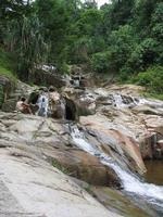 An advantage of the dry season: you can easily climb the rocks. | 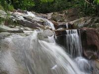 There are several places where you can take a nice shower | 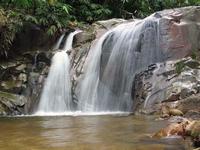 After the cascades there is one almost vertical fall with a nice pool |
|
|
|
|
|
|
|
|
|
|
|
|
|
| State | Kedah | | Location | Sik | | Coordinates and map | N05 50.51' E100 44.30' | | Water Source | Stream | | Waterfall Profile | Cascades | | Accessibility | Recreation Park |
The Perangin Sik area is located just north of Sik. It is the first of the recreation parks established in Kedah, in 1967. Locally also know as Rimba Taqwa. There is a small cascade 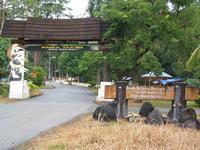 This is a big park which can accomodate many visitors | 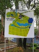 At one time there was a plan to organise the International Scout Jamboree here. | 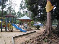 The park has all necessary amenities |
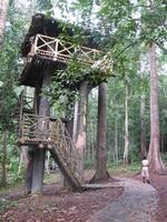 There is even a watchtower, although the surrounding forest will block the view | 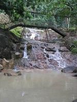 The park has a cascade and a small fall | 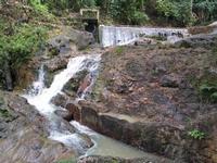 In the rainy season thise fall will be more interesting |
|
|
|
|
|
|
|
|
|
|
|
|
|
| State | Kedah | | Location | Near Serdang | | Coordinates and map | N 05 11.92' E 100 34.93' | | Water Source | Stream | | Waterfall Profile | Near Vertical Falls | | Accessibility | From carpark |
The Batu Hampar Recreational Park is located near Serdang, about 15 km from Selama. It is a small park with some facilities. During our visit a swimming/wading pool was under construction.  The signboard gives an optimistic impression of the fall |  The new wading pool |  The water catchment basin |
There are a few shelters and a footpath follows the stream. It is a pleasant place for a relaxed Sunday afternoon. |
|
|
|
|
|
|
|
|
|
|
|
| Telega Tujuh (Seven Wells) |
|
| State | Kedah | | Location | Pulau Langkawi | | Coordinates and map | N06 22.91' E99 40.38' | | Water Source | Stream | | Waterfall Profile | Vertical Fall | | Accessibility | From carpark & trekking |
The Seven Wells waterfall is named after the seven pools (wells) that can be found at the top of the waterfall.
The entrance to the well-kept park is near the famous Cable Car Station. From the car park you follow the road until a signboard where the right trail climbs steeply up to the actual wells. The left trail leads to the fall. 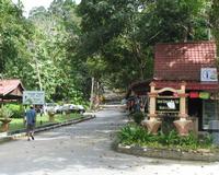 The entrance of Telaga Tujoh | 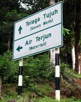 The left trail leads to the fall | 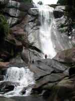 The Telaga Tujoh fall |
The waterfall is quite impressive, but you have to choose the rainy season, as the water flow is seasonal. September is a good time to visit the Langkawi falls. 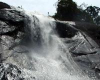 The top part of the fall | 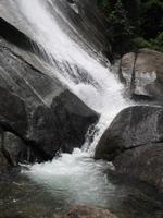 Lower part of the fall | 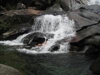 Easy to spend hours here! | [/tr]
The waterfall is a popular one and attracts many visitors. When you want to visit the 'wells', you have to climb up a steep, well-maintained trail to the top of the waterfall. 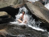 Jacuzzi Meditation.... | 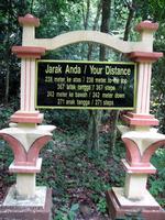 Along the trail to the wells | 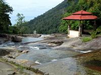 Some of the seven wells | [/tr]
Even in the dry season, the wells will generally have enough water for a bath. Be careful walking to the edge, the rocks can be slippery. It is possible to trek into the jungle. 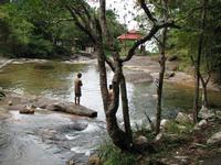 Nice pools for a quiet bath | 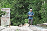 Danger! Rocks may be slippery. | |
|
|
|
|
|
|
|
|
|
|
|
|
| State | Kedah | | Location | Langkawi | | Coordinates and map | N06 25.87' E99 42.50' | | Water Source | Stream | | Waterfall Profile | Vertical Fall | | Accessibility | From carpark |
The Temurun waterfall is the tallest waterfall in Langkawi. It is a seasonal fall, best to be visited in September-October. To reach the fall, you follow the signs for the Damai Bay resort. The waterfall is visible from the road. You can park your car and then it is only a short walk to the first tier of the fall. 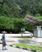 Visible from the road | 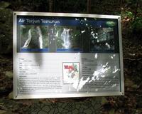 Explanation about the geological background of the fall | 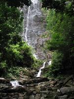 Only a short walk to the fall |
The waterfall consist of a few tiers. The lower ones are small, the main one is quite impressive. Impossible to take a picture of the whole fall. 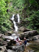 The lower tiers | 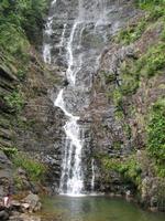 The main fall | 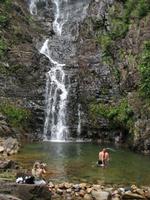 With a nice pool | [/tr]
We did not see a way to climb to the top of the waterfall. The pool is rather shallow, but deep enough for a swim and a bath. 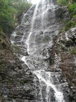 Detail of the fall | 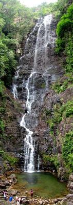 Composite picture of the fall | 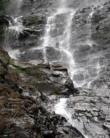 A spray of water |
|
|
|
|
|
|
|
|
|
|
|
|
|
| State | Kedah | | Location | 15 km east of Kulim | | Coordinates and map | N05 23.17' E100 40.09' | | Water Source | Small River | | Waterfall Profile | Rapids and a small fall | | Accessibility | Carpark |
The Ulu Paip Recreational Forest is located about 15 kn East of Kulim. From Kulim follow the road to Grik. The Park is clearly signposted. A small river runs through the park with several rapids and a small waterfall. Nothing spectacular, but a nice place for a family picnic. There are a few shelters. 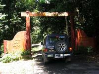 The entrance of Ulu Paip Recreational Forest | 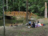 Suitable for a family picnic | 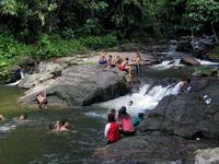 A popular place |
There are several nice wading pools in the river and a few cascades. The main waterfall is a bit disappointing because of the waterpipes spoiling the view. 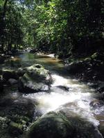 The forest surrounding the river creates a cool, relaxed atmosphere. | 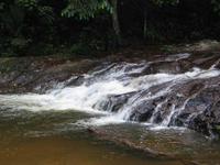 One of the cascades. | 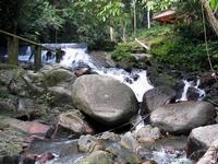 The main waterfall | [/tr]
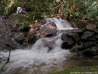 This is the first waterfall encountered | Recently some waterfall hunters have explored the upper regions of the river and found more waterfalls. Access is not easy, as no trail exists.
Pictures courtesy of Dr Chan Ah Lak, Taiping | 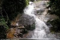 The third waterfall is a substantial one with a nice pool. | [/tr]
| |
[/td] |
|
|
|
|
|
|
|
|
|
|
| |
Category: Negeri & Negara
|